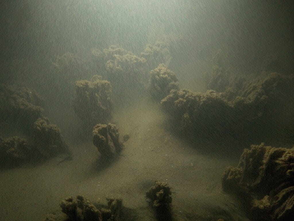
Marine biodiversity surveys in shallow coastal and estuarine environments are notoriously difficult when waters are turbid. Suspended sediments, organic matter, and hydrodynamic disturbance reduce visibility, hampering visual surveys. These conditions are prevalent in much of the North Sea, Irish Sea, and wider North-East Atlantic – especially between September and March, when sea conditions are more dynamic. Even during summer months, underwater visibility can remain limited at important port and energy infrastructure sites such as offshore wind farms and nuclear power facilities.
The challenge of turbidity
In these settings, extractive techniques like grabs or trawls may be restricted due to habitat sensitivity or the presence of subsea infrastructure. Non-destructive optical methods – such as drop-down cameras, ROVs, and BRUVs – offer lower-impact alternatives but rely heavily on adequate visibility to function effectively. In turbid conditions, their utility is severely constrained 1.
A longstanding concept: origins of the freshwater lens
The idea of using a clear medium to displace turbid water in front of an optical sensor has been around for decades. In 1997, Fang described divers using plastic bags of freshwater as makeshift “clearwater masks” for inspecting submerged infrastructure 2. Around the same time, Coles et al. reported the use of handheld illuminated underwater seagrass viewers in Australia to facilitate ecological observations in turbid shallows 3.
Since then, the concept has seen various adaptations – from clear boxes used for bridge inspections 4 to compact GoPro-compatible lens housings 5. More recently, several marine survey companies have developed their own versions of freshwater lens systems and have used them operationally in the marine environmental sector.
However, none of these systems had been subjected to controlled, scientific validation to test their impact on image quality or ecological outcomes – until the collaboration between Ocean Ecology and Swansea University. This academic/industrial partnership was the first to rigorously test and statistically prove that the use of a freshwater lens system could significantly improve ecological data derived from turbid environments. That makes the Ocean Ecology Clear Liquid Optical Chamber (CLOC) the only scientifically validated system of its kind currently in use.
Scientifically proven
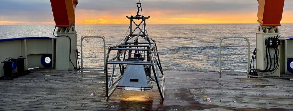
Our CLOC unit consists of a robust housing integrated into a drop-down camera frame, filled with approximately 75 litres of clear, fresh water to displace turbid seawater in the camera’s field of view.
The Swansea University research, undertaken as part of a PhD programme on camera methods in low-visibility marine environments, did not involve the design of the CLOC system. Rather, it focused on scientifically validating whether such freshwater housing systems could measurably enhance image-based biodiversity data.
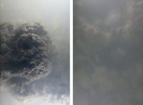
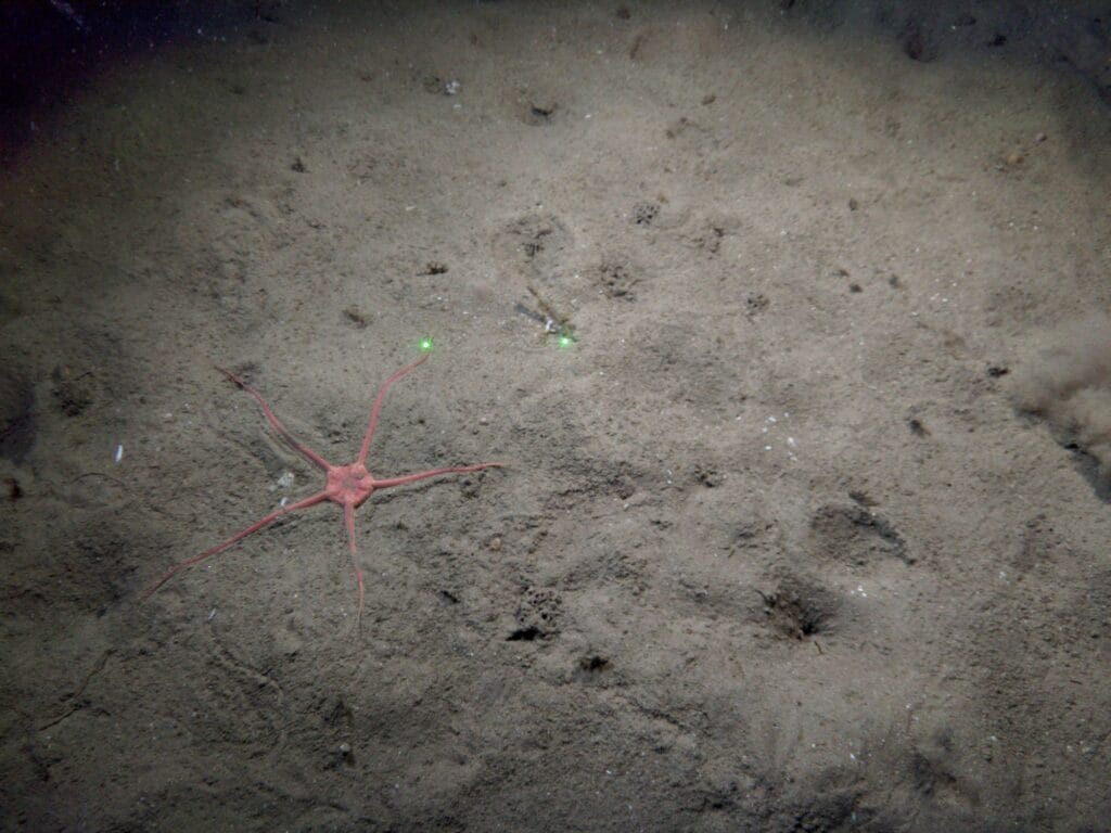
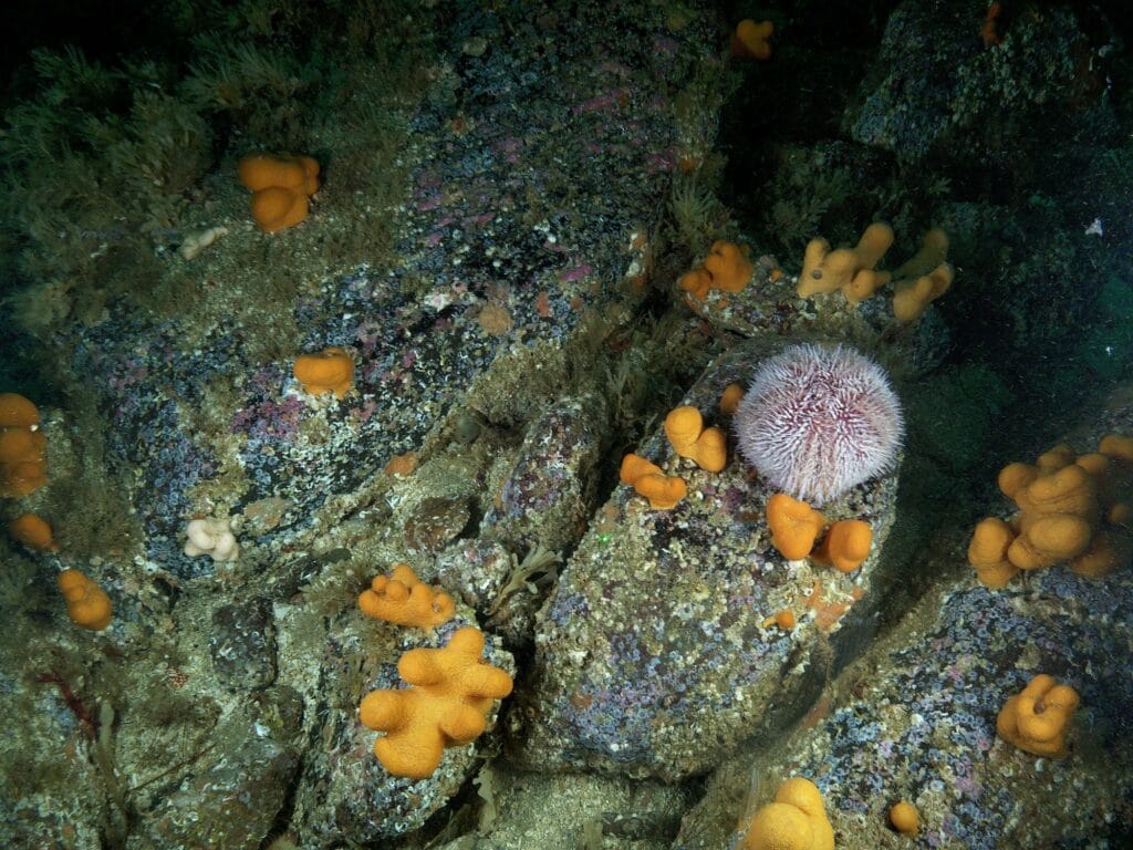
In controlled experiments and field trials, the CLOC system produced a marked improvement in image clarity and ecological data acquisition compared to standard systems, especially for benthic habitats 6.
Key findings from validation studies
Results from the peer-reviewed study published in Aquatic Conservation included:
- 49% improvement in image clarity, enhancing the detection of substrate features and biological assemblages.
- 34% increase in visible seabed area per image, expanding effective survey coverage.
- 27% increase in taxa detected, particularly benefiting cryptic and small-bodied fauna often missed in standard turbid imagery.
- Higher inter-analyst agreement, demonstrating improved confidence and consistency in image-based biodiversity assessments.
These findings highlight the unique value of employing CLOC systems in turbid coastal and shelf environments, particularly where traditional sampling is constrained or where non-destructive techniques are mandated.
Deployment versatility
The CLOC unit has been engineered for seamless integration with a range of camera systems, including:
- Drop-down and towed frame cameras
- BRUV frames
- HD video and still image systems
Its rugged construction and stability on the seabed make it suitable for use in high-energy marine environments. To date, it has been successfully deployed for:
- Habitat classification and condition monitoring
- Fish and mobile fauna surveys
- Pre and post-consent impact assessments
- Decommissioning studies
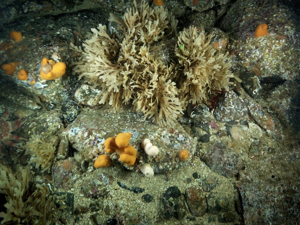
For instance, in a recent North Sea deployment near offshore infrastructure, Ocean Ecology’s client required non-invasive survey methods because of the presence of sensitive reef habitats. The CLOC system enabled high-quality imagery of benthic communities where other approaches would have been ineffective or ecologically intrusive.
Fit for the future
CLOC systems also complement broader technological developments in marine survey practice. Acoustic systems, such as ARIS and DIDSON, offer utility in zero-visibility conditions for detecting large targets but lack the taxonomic resolution needed for biodiversity assessments. Meanwhile, AI-based tools for automated annotation, are only as good as the image data they process 7.
The system also improves front-end image capture, enhancing the quality of input data for both human experts and automated workflows. When combined with sonar, machine learning, and structured survey design, it provides a powerful toolkit for assessing seabed biodiversity under real-world constraints.
Research-driven
CLOC’s validation was made possible through a multi-year academic–industrial collaboration under the Swansea University PhD programme, co-funded by SEACAMS2 and the KESS scheme. This ensured:
- Rigorous lab and field-based experimentation
- Statistically robust ecological performance metrics
- Peer-reviewed publication and open access dissemination
- Alignment with regulatory expectations and best-practice survey standards
By combining our technical expertise with Swansea University’s academic rigour, the research provides independent verification of the system’s ecological benefits and practical value.
Get in touch
The Ocean Ecology CLOC system empowers its surveyors to collect high-quality, non-destructive imagery in challenging conditions – transforming how we observe and assess marine habitats in turbid waters.
Whether you’re working in offshore renewables, estuarine development, conservation monitoring, or decommissioning, the ability to “see through the murk” without disturbing the seabed can make all the difference.
Our CLOC system remains the only scientifically validated freshwater lens camera system proven to improve benthic biodiversity assessments in turbid marine environments.
Interested in using CLOC for your next project?
Get in touch with our team – we’d be happy to discuss how this system can support your environmental survey goals.
References
- Jones, R. E., et al. (2019). Improving visual biodiversity assessments of motile fauna in turbid aquatic environments. Limnol. Oceanogr. Methods, 17, 544–554.
- Fang, H. (1997). Use of freshwater masks in underwater inspection. Journal of Underwater Engineering, 22(2), 34–38.
- Coles, R. G., Lee Long, W. J., & McKenzie, L. J. (1997). Seagrass viewing in turbid conditions using illuminated lenses. Great Barrier Reef Marine Park Authority.
- Browne, D. et al. (2010). Clearwater boxes for underwater bridge inspection. FHWA Technical Note, US Department of Transportation.
- Sexton Underwater Products (2017). Clear lens GoPro housings for turbid water filming.
- Jones, R. E., et al. (2020). Improving benthic biodiversity assessments in turbid aquatic environments using a novel freshwater optical chamber. Aquatic Conservation: Marine and Freshwater Ecosystems, 31, 1221–1235.
- Durden, J. M., et al. (2021). Challenges and solutions for image-based biodiversity surveys of the seafloor. Frontiers in Marine Science, 8, 650292.